Highlights
- Still a relatively unspoiled trekking destination, but gaining in popularity
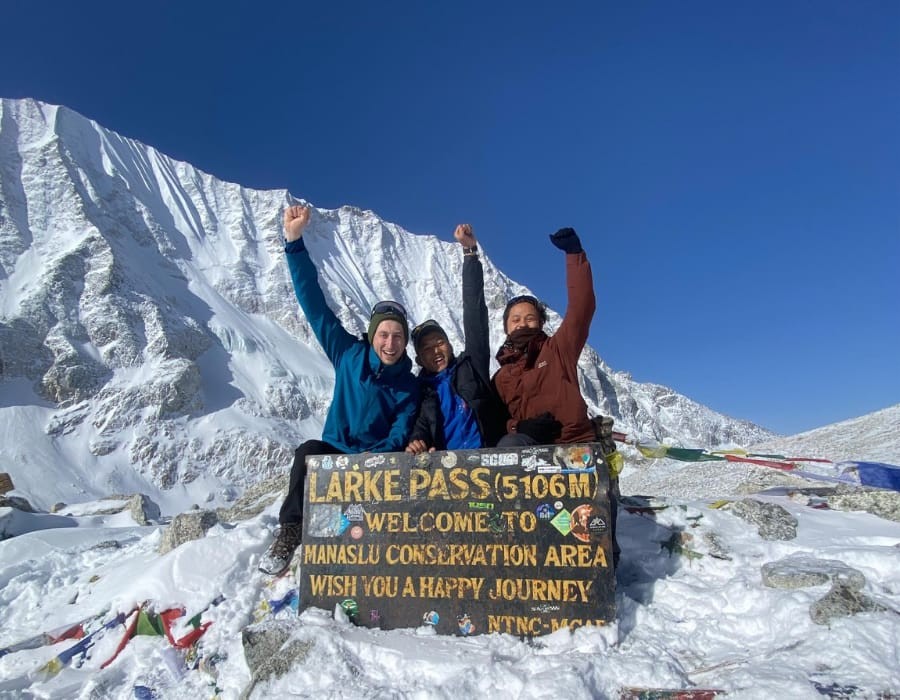
- Fantastic views of Mt. Manaslu and other high mountains in the area, and of the Annapurna range from Larkya La pass (5160 m)
- Diverse landscapes from the lower areas with diverse vegetation into the alpine regions
- Traditional Tibetan-style villages and lifestyle
- Explore the traditional, unspoiled lifestyle of the people in the area.
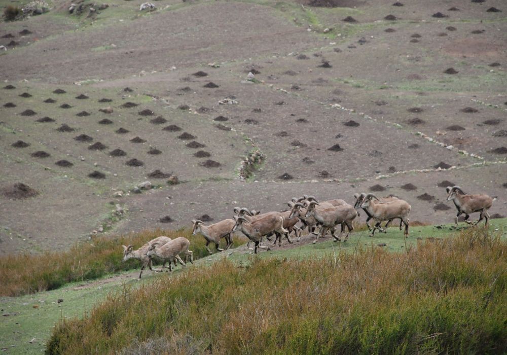
- Rich flora and fauna, including blue sheep and the rare snow leopard
- Old monasteries
About Manaslu Circuit Trek - 13 days
Have you ever dreamed of trekking through a truly remote Himalayan region where towering snow peaks, ancient culture, and untouched nature come together? The Manaslu Circuit Trek offers exactly that experience.
If you are planning a trek to the Manaslu region and looking for the raw Himalayan experience, especially if you're short on time? That's something we can help you with. We've also included 12 days, 18 days, and one more special itinerary variation on this page.
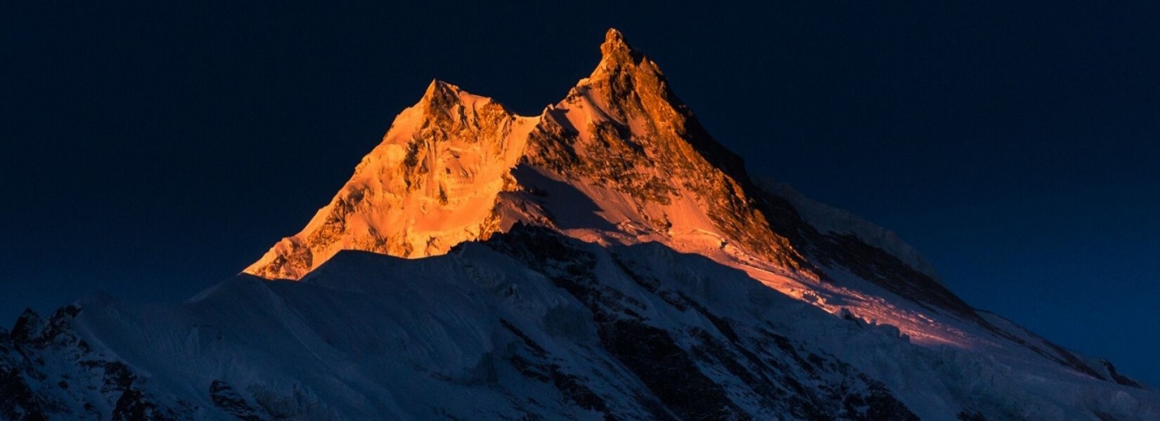
North-west of Kathmandu, and located against the Tibetan border, is the Mansiri Himal range. Among them stands the world's 8th-highest mountain, dramatic 8163 meters. Its name means "the Mountain of the Spirit, a revered Himalayan giant. Its name is Manaslu, and it was conquered only three years after the first ascent of Everest, marking another milestone in Mountaineering.
Overview of Manaslu Circuit Trek
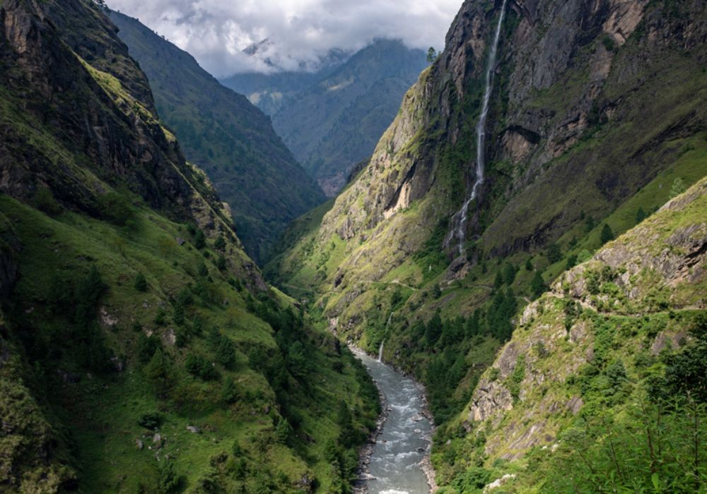
The Manaslu Circuit Trek encircles Mt. Manaslu in the Manaslu Conservation Area, near the Nepal-Tibet border, in the Manaslu Region, Nepal. The region is still in pristine condition. The trek starts from subtropical Budi Gandaki River valleys to high alpine terrain and glaciated passes, and meets in the Annapurna Region.
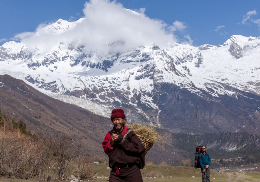
It has the flavour of Tibet as its settlers came southward from the Tibetan Plateau over 1000 years ago. The land is Tibetan Buddhist; its language is a dialect of Tibet. Many of the people here don't even speak Nepali, and for all practical purposes, this land has been isolated from the world.
The people practice a form of Buddhism which strictly adheres to the practice of not killing any animal for food. Wild animals have no fear of man, as they have learned humanity is not their enemy.
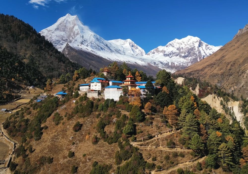
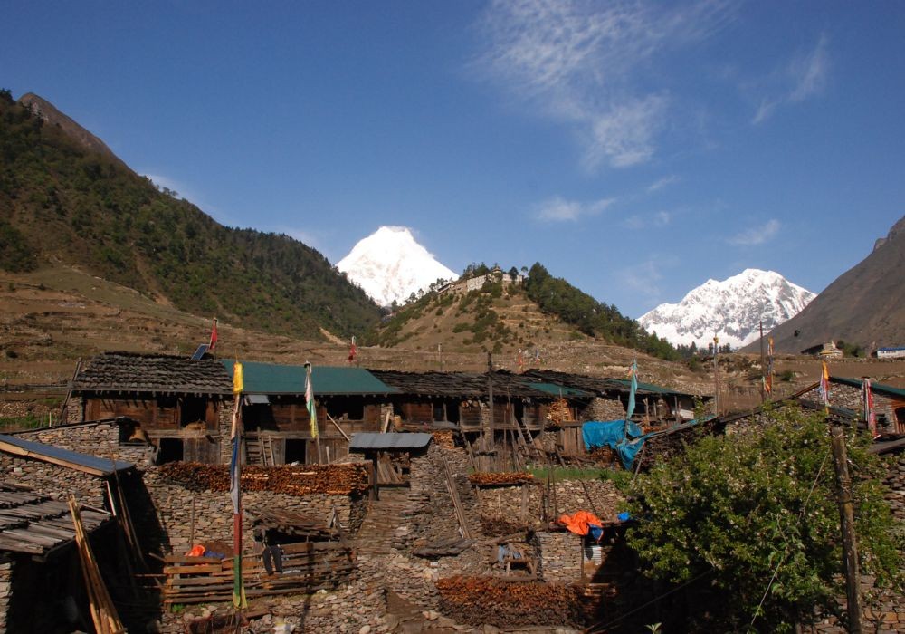
People farm with yaks and use them to move goods in and out of the valley. Few stores are stocked with goods from China, and almost every village has a Gomba (Buddhist Monastery). Some of the monasteries in the Manaslu Region are larger, like the Serang Gompa. To the north are more snowcapped mountains that form a barrier with Tibet-China.
The people live as they have for hundreds of years. Women work in the small fields and take care of the homes; the men work outside and earn what money they can find. They practice a spirit of non-violence and peace, in keeping with the teachings of the Buddha.
Their diets consist of wheat, buckwheat, barley, potatoes and bread. They enjoy traditional Tibetan Butter Tea, which they serve in steaming cups that warms agaisnst the cold winds that blow through the valley.
Everyone wears some kind of medallion with a picture of the Dalai Lama on it. Each home has its own temple which are beautifuly decorated in bright colours and pictures.
Houses are usually two-story, with animals onthe first level. Much ofthe second floor is devoted to storage of food items, with little space just for living. Most activity in the homes is centred around the kitchen, but they will sleep in cold rooms on the veranda.
Tourism is relatively new in the region, but the people have caught on quickly. People can be shy as they meet strangers. The children will come to look at you, but will often shy away when you talk to them. Still others will follow, amazed to see a foreigner in their midst.
You will pass yaks grazing in the fields. Monkeys will come and look at you as they move out of the forest. Rivers tumble over falls and boil over the rocks. The rivers are all glacier-fed and have a dark greenish-blue colour to them.
Buddhist player flags flutter in the constant breeze. The women carry traditional silver spoons suspended on a string around their waists. Everyone smiles and bears a greeting.
We’ve been navigating Manaslu since the early 1990s, long before the first teahouse was built and decades before 'convenience' became part of the trekking experience. Every supply was carried on back, and every camp was a feat of logistics. The region has embraced tourism. Once-silent trails now offer cosy beds and warm meals at day’s end.
Manaslu is still a restricted area, requiring guides and permits, offering a less crowded, classic trekking experience similar to what Everest Base Camp and Annapurna Base Camp offered decades ago.
Where does the Manaslu Circuit Trek begin?
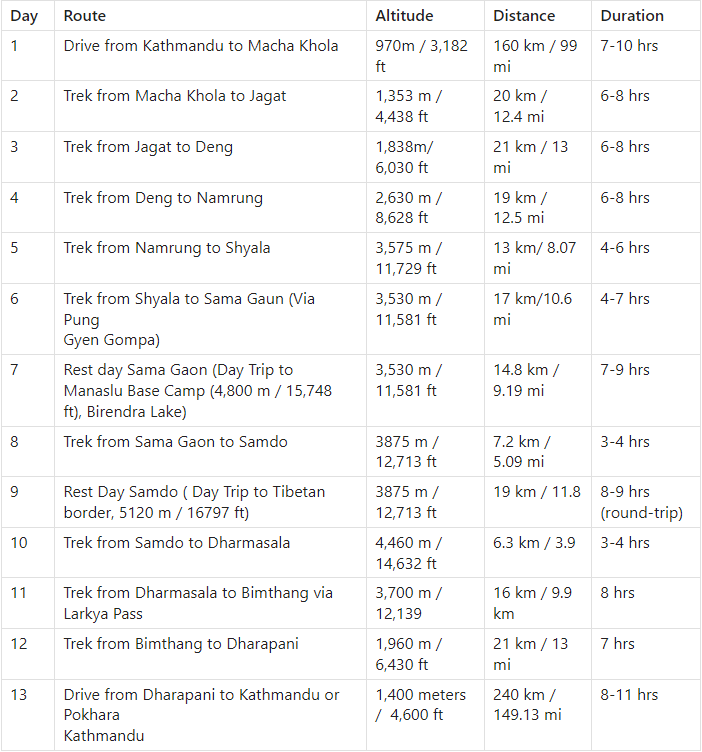
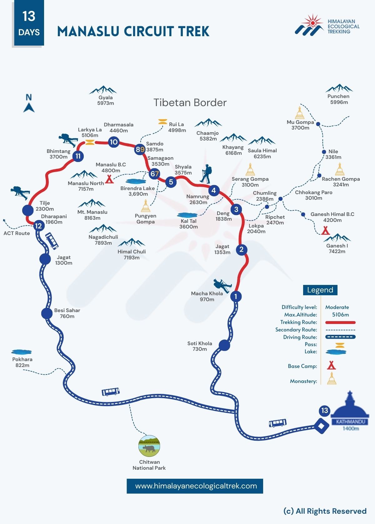
First, you fly into Kathmandu, and we meet you at the airport. Transfer you to your Hotel in a private vehicle. Later, you meet your guide, receive a brief orientation of the trek, and checking equipments. The following day, we take a scenic drive to Macha Khola. From there, we follow the Budi Gandaki River upstream through villages like Jagat, Deng, Namrung, and Shyala. From Shyala, we take a detour hike to Pungen Gompa and then move to Samagaon.
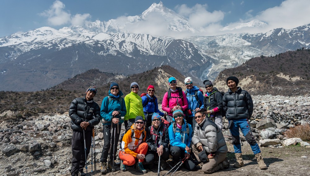
We stop for a day in Samagaon to acclimatise and rest, or take side trips like Birendra Lake of Manaslu Base Camp. Then we proceed to Samdo and spend another day resting or take side trips to the Tibetan border and Samdo Peak.
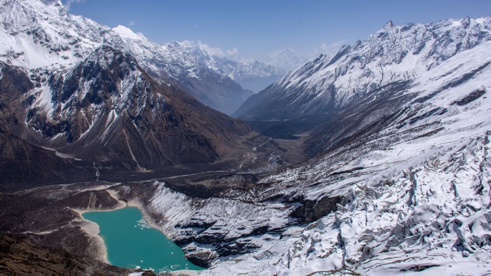
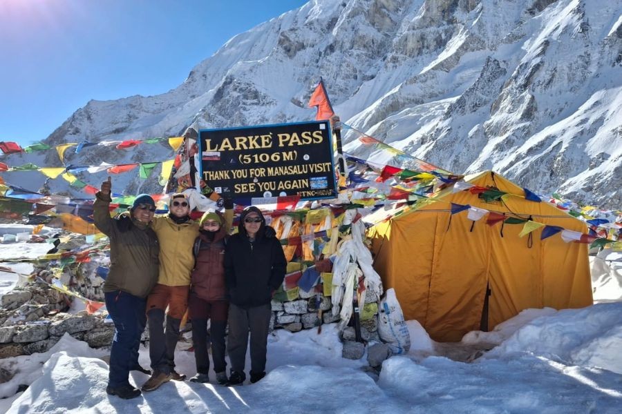
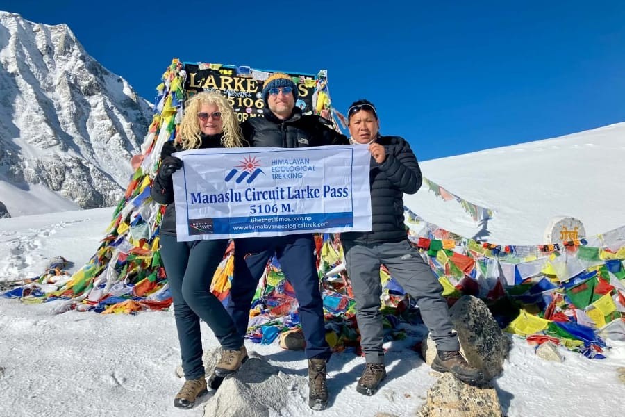
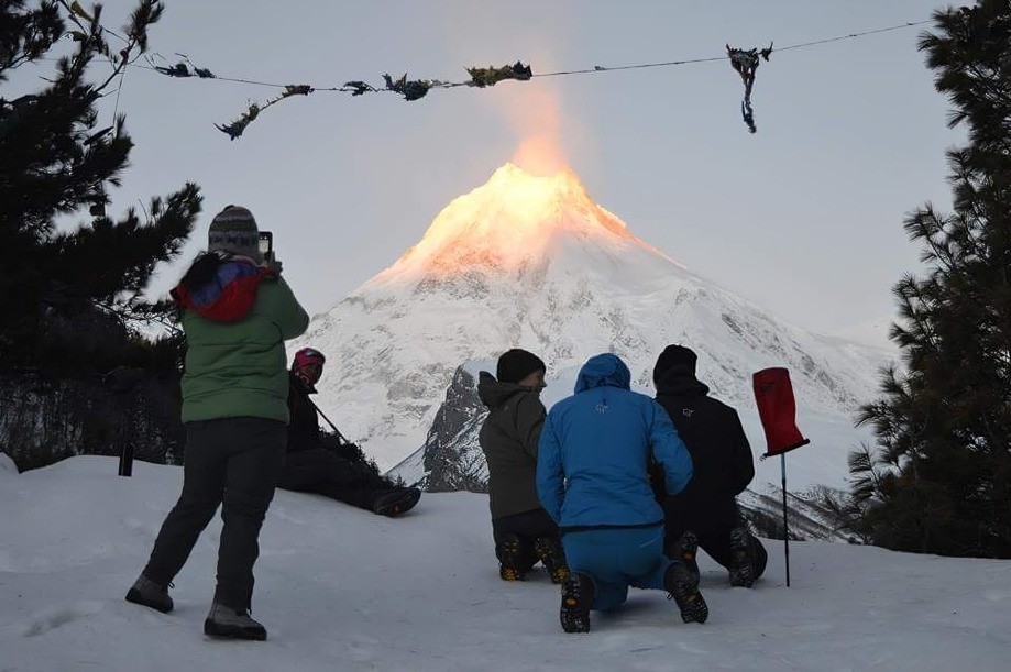
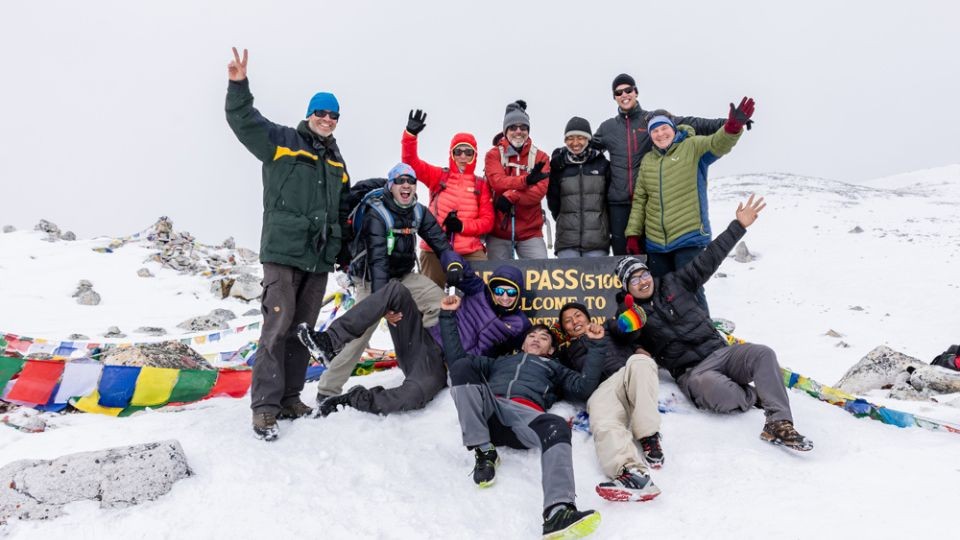
We continue to Dharmasala, where we will spend a night before crossing Larkya La, the highest point of our trek, before proceeding to Bhimtang.
After a final push, we reach Dharapani, where we celebrate our trek completion and drive to Kathmandu the following day.
To make this easier to follow, the full Manaslu Circuit itinerary is outlined day by day below
Manaslu Circuit Trek Facts
- Region: In Gorkha District, around Mt. Manaslu (8163m - Eighth highest mountain in the world)
- Duration: 13 Days (can be extended)
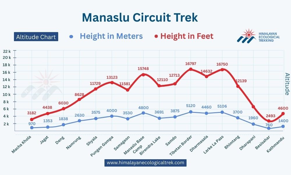
- Highest Point: Larkya La Pass ( 5160m/ 16929 ft)
- Total Trekking Distance: Around 175 km/ 108 mi
- Difficulty: non-technical, requires acclimatisation.
- Trek Start Point: Macha Khola (970m/3,182ft)
- Trek Ending Point: Dharapani (1,960m/6,430ft)
- Accommodation: Teahouse and Guesthouse Lodges
- Minimum group Size: 2 trekkers+ Licensed Guide (Solo? contact us)
- Guide requirement: Mandatory (Restricted area)
- Cultural Zone: Tibetan-influenced Nubri Valley, ancient monasteries, chortens.
- Crowd level: Less crowded than the Everest/ Annapurna Circuit.
- Best Seasons: From March to May (flowers, clearer mornings), September to November (Stable weather, best visibility)
- Wildlife often seen: Himalayan Thar, Blue sheep; Snow leopard (Rare sightings)
- Permits Required: Manaslu Conservation Area Permit (MCAP), Annapurna Conservation Area Permit (ACAP), Chumnubri Rural Municipality Permit (CRMP), Restricted Area Permit (RAP)
Benefits of Trekking with HET
- No Booking Deposit required, Reserve now, and pay upon arrival.
- Free Online Briefing, consultation before booking, by Bikesh, the adventure expert with 3 decades of expertise.
- Free Sleeping Bags, Down Jackets, Trekking Poles, Crampons, water bottles, water purifying tablets (Items to be returned after trek).
- Local Experts (Trek is led by a professional guide born and raised in the Manalsu Region)
- Complimentary Airport pickup and drop off by private vehicle
- 100% Guaranteed Departure
- Seasonal Fruits are served every day after dinner during the trek.
- Free excess luggage storage at the HET store during the Manaslu Circuit Trek.
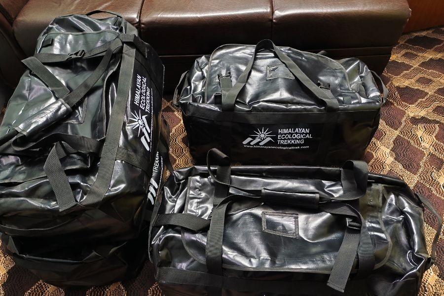
- HET Branded waterproof duffel bags (You can take home if you need/like)
- Eco Bag to keep the Manaslu Region Clean.
- 100% Excellent and positive reviews from our previous clients on Google, TripAdvisor and Trustpilot
- Best Competitive Price Guaranteed
Manaslu Circuit Trek Itinerary Overview
Useful Information
How to Make a Booking
To book your trip, simply find and click on the “Customise Your Trip” button at the top and fill in your preferred travel dates, group size, and any special requests. Once we receive your details, our team will get back to you promptly.
Alternatively, you can click “
ReserveNow” to secure your spot directly.
Let us help you plan your perfect Himalayan adventure.
What Makes Your Journey with Us Different?
At Himalayan Ecological Trekking, we believe tourism should be a force for good, and that takes responsibility for the land and its people. Beyond the breathtaking views, your trip supports our mission of Responsible Tourism. For over 25 years, we have reinvested in the remote regions we explore, ensuring your journey supports the land and its people. We take great pride in our long-standing history of community support in Nepal. We have transformed rural education by developing 7 regional schools. Beyond the classroom, we bring vital healthcare to remote hill areas and empower the trekking community through Porter's Progress, an initiative dedicated to providing porters with the gear they need for the trail.
Proven Commitment: Since 2009, we have built and restored multiple earthquake-resistant schools in rural regions like Dhading and Sindhupalchowk.
A Commitment to Sustainability: We are among the few operators with a formal, transparent Sustainability Policy. We don't just follow procedures; we set standards for socially and environmentally conscious travel.
Manaslu Circuit Trek Route Map
Manaslu Circuit Trek Elevation / Altitude
Manaslu Circuit Itineraries Options:
Manaslu Circuit Trek 12 Days
Day 1: Kathmandu/ Drive to Machkhola
Day 2: Machakhola/ Trek to Jagat
Day 3: Jagat/ Deng
Day 4: Deng/Namrung
Day 5: Namrung/ Shyala
Day 6: Shyala/Sama (via Pungyen)
Day 7: Sama Rest (Birendra Lake, Manaslu Base Camp)
Day 8: Sama/ Samdo
Day 9: Samdo/ Dharmasala
Day 10: Dharmasala/ Bhimtang (via Larkya La)
Day 11: Bhimtang/ Dharapani
Day 12: Dharapani/ Drive to Kathmandu or Pokhara
The price is per person, 750 USD for two people
Manaslu Tsum Valley Trek 18 Days
Day 1: Kathmandu/ Drive to Machha Khola
Day 2: Machakhola/ Trek to Jagat
Day 3: Jagat/ Lokpa
Day 4: Lokpa/ Chumling
Day 5: Chumling/ Chhokangparo
Day 6: Chhokangparo/ Nile
Day 7: Acclimatisation Day at Nile - Hike to Mu Gompa
Day 8: Nile/ Chuling
Day 9: Chumling/ Deng
Day 10: Deng/ Namrung
Day 11: Namrung/ Shyala
Day 12: Shyala/ Sama Gaon
Day 13: Sama Gaon/ Samdo
Day 14: Acclimatisation day: Side Trip hike to Rui La (Tibetan Border)
Day 15: Samdo/ Dharamshala
Day 16: Dharmasala/ Bhimtang Via Larke-La (5106m/ 16751ft)
Day 17: Bhimtang/ Dharapani
Day 18: Dharapni/ Drive to Kathmandu or Pokhara
Join our group departing on 22April for the Manslu Tsum Valley 18-days itinerary above. Feel free to drop us message for cost and details. We provide most competitive prices and high-end service.
Manaslu Tsum Valley Hidden Route
Day 1: Kathmandu/ Drive to Machha Khola
Day 2: Machakhola/ Trek to Jagat
Day 3: Jagat/ Lokpa
Day 4: Lokpa/ Ripchet
Day 5: Ripchet/ Gumba Lungdang
Day 8: Day hike to Ganesh Himal Base Camp; Back to Gumba Lungdang
Day 9: Gumba Lungdang/ Lamagaon
Day 10: Rest Day, visit the Monasteries and Milarepa cave
Day 11: Lamagaon/ Mu gumba
Day 12: Visit Chho Syong and Trek to Rachen Gumba
Day 13: Rachen Gumba/ Chumling
Day 14: Chumling to Thorjong
Day 15: Thorjong/ Bihi Phedi (Joined Manaslu Route)
Day 16: Visit the Serang gumba after lunch; then to Prok
Day 17: Day trip to Kal tal (3574m), back to Prok
Day 18: Prok/ Namrung
Day 19: Namrung to Shyala
Day 20: Shyala/ Sama via Pung Gyen Gompa
Day 21: Sama to Samdo via Birendra Lake
Day 22: Rest day, or Hike to Tibetan border or Samdo Peak
Day 23: Samdo/ Dharamsala
Day 24: Dharamsala/ Bhimthang via Larke-pass(5106m)
Day 25: Bhimthang/ Dharapani
Day 26: Dharapani/ Drive to Kathmandu or Pokhara
If the itineraries above don’t quite fit your timeframe and preferences, we can adjust or create one that suits you.
Manaslu Circuit Trek Packing List
Documents & Essentials
Passport (valid for at least 6 months)
Visa (Nepal)
Trekking permits (Manaslu Restricted Area Permit, Manaslu Conservation Area Permit - MCAP, Chumnubri Rural Village Permit) (Taken care of by the Company)
Travel insurance (covering trekking & high-altitude). Provide 1 copy to the company
Cash for personal expenses (Nepali Rupees; ATMs are limited along the trail)
Flight tickets/itinerary
Emergency contact list & copies of documents
1. Clothing
Base Layers:
Moisture-wicking t-shirts (short & long-sleeve)
Thermal tops and bottoms
Lightweight trekking pants
Underwear and quick-dry socks (several pairs)
Insulation Layer:
Outer Layer:
Waterproof & windproof jacket (Gore-Tex recommended)
Waterproof trekking pants
Warm hat and sun hat
Gloves (thermal & waterproof)
Buff or neck gaiter
Footwear:
Sturdy trekking boots (well-broken-in)
Comfortable camp shoes/sandals
Gaiters (optional, for snow/mud)
2. Trekking Gear
Daypack (25–35L)
Sleeping bag (rated to −10°C/14°F or more) (Provided by Company if needed)
Trekking poles (collapsible) (Provided by Company if needed)
Headlamp with extra batteries
Sunglasses (UV protection)
Water bottles or hydration system (2–3 L capacity) (Provided by Company if needed)
Water purification tablets/filter (Provided by Company if needed)
Personal trekking map & compass / GPS (Provided by Company)
3. Personal Items
Sunscreen (high SPF) & lip balm
Toiletries (toothbrush, toothpaste, biodegradable soap)
Quick-dry towel
Toilet paper/tissue packs
Hand sanitizer
Personal medications & first-aid kit (blister plasters, bandages, painkillers) (Basic first-aid) Aid Kit is also carried by Guide)
Sleeping liner (optional, for teahouse hygiene)
Trekking snacks (nuts, energy bars)
4. Electronics
5. Optional Extras
Lightweight binoculars
Notebook & pen
Playing cards / small games
Small daypack for side excursions
Microspikes/crampons (if trekking during icy conditions) (Provided by Company if needed)
Tips for Packing
Layering is key: temperatures vary from tropical valleys to alpine zones.
Limit your backpack to 12–15 kg for comfort.
Bring only essentials during the trek. You can store excess luggage at Kathmandu hotel or at our office for free.
Choose quick-dry and moisture-wicking fabrics.
Keep electronics and documents in waterproof pouches.
What is the best time for the Manaslu Circuit trek?
The best seasons to trek in Manaslu are autumn and spring. A little cold weather at night, but warm and clear days and clear views of the spectacular mountain ranges. Often clouds appear in the afternoon, creating an interesting atmosphere and different but no less stunning views of the mountains.
Each Season has its own pros and cons. Choose your timing carefully for the best experience:
Spring Season (March-May):
- Clear mountain views after winter storms
- Rhododendron blooms in lower elevations
- Moderate temperatures and stable weather
- Good visibility for photography
- Slightly crowded but manageable
Manaslu Circuit Trek in Spring
Autumn Season (September-November):
- Crystal clear mountain views
- Stable weather conditions
- Perfect temperatures for trekking
- Dry trails and reliable tea house services
- Peak season with more trekkers
Manaslu Circuit Trek in Autumn
Winter Season (December-February):
- Extremely cold temperatures at high altitude
- Snow on Larkya La Pass
- Limited tea house services
- Challenging conditions but fewer crowds
- Requires extensive cold-weather gear
Manaslu Circuit Trek in Winter
Monsoon Season (June-August):
- Heavy rainfall and leeches in the lower sections
- Cloud cover obscuring mountain views
- Risk of landslides and trail washouts
- Generally not recommended for trekking
- Some tea houses may close
Manaslu Circuit Trek in Summer-Monsoon
Choose spring or autumn for the best combination of weather, views, and services along the route.
Best Time for Manaslu Circuit
Manaslu Circuit Trek Weather and Temperature by Seasons
How difficult is the Manaslu trek?
The Manaslu circuit trek is considered moderately difficult. The trail slowly ascends into the mountain areas, and we slowly gain altitude. Some of the walking days may be lengthy, particularly the day when crossing the Larke-La pass is a long day, and you need to be able to walk on rugged, steep terrain.
Can I do a trek without a guide?
Trekking in most of the Manaslu area without a guide is not possible. It is a restricted zone, and as per the law of the Nepal government, a licensed guide and special permit are compulsory for the safety and security of trekkers.
What kind of permit is required for the Manaslu Circuit trek?
Travelling to the Manaslu region requires a special permit and a group of at least two trekkers. Because the trekking region is in a remote part of Nepal and is relatively high in altitude, there is a risk that trekkers get lost or suffer from altitude sickness. To avoid these situations, the Nepalese government has made a guide and special permit compulsory for trekking in this region.
You will need four permits for this trek, in fact:
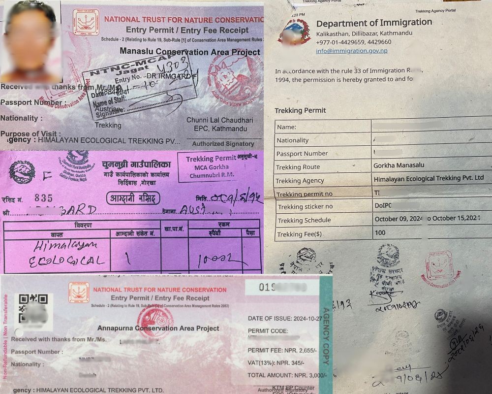
- Special Restricted Area Permit for Manaslu (Manaslu RAP Permit)
- Manaslu Conservation Area Project (MCAP Permit)
- Annapurna Conservation Area Project (ACAP Permit)
- Chumnubri Rural Municipality Permit (CRMP)
What is the cost of the required permits and fees for the Manaslu circuit trek?
- Special Restricted Area Permit for Manaslu (Manaslu RAP Permit): the cost varies according to the season. From September to November, it is USD 100 for 7 days, and each extra day costs USD 15. The rest of the year (December-August) costs USD 75 for 7 days, and each extra day costs USD 10.
- Manaslu Conservation Area Project (MCAP Permit): 3000 NPR
- Annapurna Conservation Area Project (ACAP Permit): 3000 NPR
- Chumnubri Rural Municipality Permit
What is the highest point on the Manaslu circuit trek?
At 5160 meters (16929 feet) above sea level, the Larkya La Pass reaches the highest elevation point during the Manaslu Circuit trek. The remarkable panorama of surrounding mountains strikes trekkers at this tricky elevation region because of the demanding mountainous conditions and tall elevations that exceed 5000 meters.
How can I prevent getting altitude sickness?
This is a guided trek, and you will be accompanied by one of Nepal's experienced trekking guides who knows how to recognize altitude sickness (as there may be other physical conditions as well with similar symptoms) and who knows what to do. They will take very good care of you.
In general, you must climb up slowly not much more than 500 meters (altitude of night stay) per day. Drink plenty of water and avoid smoking and drinking liquor. If symptoms of altitude sickness are observed, climb slowly or stop for a rest day (depending on intensity), allowing your body to adjust. If symptoms persist and/or get worse, you must move to a lower altitude to avoid life-threatening conditions.
How are Emergencies Handled?
At HET, your safety is our top priority. Our guides are trained in first aid, altitude awareness, and emergency response, enabling them to act calmly and effectively in any unexpected situation. They maintain regular contact via mobile or satellite communication, ensuring quick coordination of assistance even in remote areas. All field teams are supported by our Kathmandu office, which provides 24/7 backup for logistics, medical guidance, and emergency decision-making.
Prevention is key on all our treks. We conduct daily health check-ins, build acclimatisation days into our itineraries, and provide clear guidance on hydration, nutrition, and pacing. For minor problems, our team offers immediate first aid on the trail. For mild altitude sickness, trekkers receive rest, fluids, and medication such as acetazolamide if prescribed. If symptoms continue or intensify, the safest and most effective approach is to descend to a lower altitude, which typically eases the condition quickly.
HET also provides small bottled oxygen with a mask for emergencies, ensuring trekkers have supplemental support when needed. In more serious cases, trekkers may be escorted to nearby health posts in Namrung, Samagaun, or Samdo, or other villages along the route such as Machha Khola, Jagat, Deng, Bhimtang, and Dharapani, where basic medical care and oxygen are available.
For critical situations, including severe altitude illness or injury, HET arranges helicopter evacuation to Kathmandu, working with trusted rescue providers to ensure timely and professional treatment. We strongly recommend that all trekkers have travel insurance covering high-altitude trekking and emergency evacuation, which makes the rescue process smoother.
With HET, there is a clear, practical plan in place for every scenario, so you can focus on enjoying the Manaslu Circuit with confidence and peace of mind.
Do we need to arrange our own international flights to and from Nepal?
Yes, travellers are responsible for booking their own international flights. To make planning easier, we recommend using reliable flight search engines or checking airlines with frequent service to Nepal, such as Qatar Airways, Turkish Airlines, or Nepal Airlines.
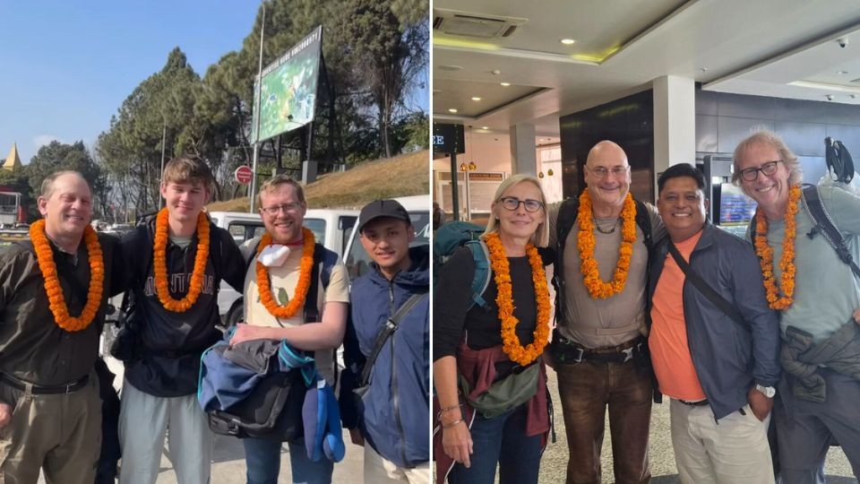
Who will meet me at the airport upon arrival?
A welcoming HET team representative will meet you at the airport, holding a sign with your name or our company name for easy identification. They’ll assist with your luggage and ensure a smooth transfer to your hotel.
How much can a porter carry?
For safety and comfort, each porter carries 20–25 kg. Typically, this means around 10–12 kg per trekker when one porter carries the bags of two trekkers along with their own items. We recommend keeping your pack within this limit and leaving any extra luggage at your hotel or with the trekking company.
What type of insurance do I need, and how do I get it?
Travel insurance is important for high-altitude routes like the Manaslu Circuit, which reaches Larkya La Pass at 5,106 meters. Your policy must include medical evacuation coverage for the trek’s maximum elevation, as helicopter rescues are often the only option in serious emergencies. Good insurance can also cover additional costs such as flight delays or cancellations due to bad weather, medical treatment, theft, or loss of personal belongings during the trek. It’s important to share a copy of your insurance policy with the tour operator so we can assist effectively if needed.
Carry both digital and printed copies of your policy and save your provider’s emergency contact details for quick access. Comprehensive insurance provides peace of mind, allowing you to focus on the trek’s stunning landscapes and cultural experiences. Providers such as World Nomads, Allianz Global Assistance, and SafetyWing offer coverage suitable for high-altitude trekking, including medical emergencies, evacuation, and protection for your gear. Be aware that insurance purchased through airlines when booking flights usually does not cover high-altitude medical evacuation, so always check the fine print to confirm altitude limits and emergency evacuation coverage.
Food and accommodation on the Manaslu Circuit Trek
Because it is a restricted region and still relatively off the beaten path, there are a limited number of simple tea houses on the way, although the number has been increasing in recent years. As for food, they will usually provide cereals (mostly muesli), toasted bread, eggs, or pancakes for breakfast and soups, pasta, sandwiches, and potato dishes, as well as traditional Nepali daal bhaat (a dish of rice, lentils, and vegetable curry). Although other items are available, we recommend sticking mostly with local food, like daal bhaat or potatoes, as this is usually safe and people know how to prepare it.
What is the temperature rating of the sleeping bags provided to trekkers?
The sleeping bags we provide are rated for temperatures as low as -25°C. Additionally, our guides can arrange extra blankets from teahouses if needed for added warmth.
I’m a vegetarian. Is that a problem?
Not at all! We fully accommodate vegetarian diets on the Manaslu Circuit and all our treks. Simply let us know in advance, and we’ll make sure your meals suit your dietary preferences throughout the trek.
Choosing vegetarian meals can also help reduce the risk of food-related illness or indigestion, especially in remote areas.
Is travel insurance required for this trek?
Yes, travel insurance is a must for those trekking in remote regions of Nepal. It is for trekkers’ safety and security and is used only in exceptional emergency cases. The insurance should cover medical emergency cases, including helicopter evacuation.
Also, emergency insurance is required for the crew (guide and porters) which is covered by HET. As serious and responsible trekking agency we ensure that all of its crew members are properly insured and adequately equipped for the trek.
How long does it take to complete the Manaslu circuit trek?
Most travellers estimate a 12- to 18-day trip to complete the Manaslu Circuit trek. The duration of the trek can be adjusted according to your bodily adjustment needs for altitude, along with optional Tsum Valley exploration time.
What are the ATM and currency exchange options in Kathmandu?
Kathmandu has a wide range of ATMs and currency exchange services. Most ATMs accept international cards, though withdrawal limits and fees may apply. Currency exchange counters are also plentiful, generally offering competitive rates.
Do you provide accommodation in Kathmandu and Pokhara?
Yes, we can arrange accommodation in Kathmandu at boutique hotels such as Hotel Vistara, Hotel Vajra, and Ramada Encore, chosen for their comfort, reliable service, and convenient locations. Please note that these hotel stays are not included in the package price we have provided and would be booked separately at the best price.
Should I tip my guide and porter? If so, how much?
Tipping is not mandatory, but it’s a customary way to show appreciation for your guide and porter’s effort and dedication. The amount depends on the trek’s length and difficulty, your group size, and the level of service provided.
For a 13-day Manaslu Circuit trek, you can tip based on daily rates:
Guide: $10–$15 per day
Porter: $5–$10 per day
Alternatively, some trekkers prefer to tip 10–15% of the total trek cost, which also works well for longer or more challenging treks. Tipping is voluntary and meant as a gesture of gratitude. If your guide and porter go above and beyond, you may choose to give a little extra.
Cultural Etiquette while Trekking in the Manaslu Region
When trekking the Manaslu Circuit or visiting any part of Nepal, being aware of local customs and cultural norms helps ensure a respectful and enjoyable experience.
Here are some important guidelines for visitors:
Respect local traditions and customs.
Remove your shoes before entering homes, monasteries, or temples.
Be polite, patient, and courteous with locals.
Respect religious beliefs and practices.
Always ask permission before taking photographs, especially in villages or of people.
Protect the environment—avoid littering or damaging natural sites.
Do not point your feet at people or religious objects.
Refrain from public displays of affection, such as kissing.
Use your right hand when giving or receiving items or shaking hands.
Avoid taking photos in areas where signs indicate it is prohibited.
Do not touch idols or sacred objects in temples and monasteries.
Remember that English may not be widely spoken in remote villages.
Avoid giving money to begging children; support local communities through responsible tourism instead.
Following these simple practices will help you enjoy the Manaslu Circuit while showing respect for the local culture and traditions.
Need Help Planning Manaslu Circuit Trek or Tsum Valley, or both?
We understand that every trekker has a different pace, comfort level, and goal, so we customise each trek accordingly. Message us at our email or WhatsApp, and we will be happy to share a tailored itinerary and cost based on your needs. Contact Us Directly: Please feel free to Email [email protected] or WhatsApp +977 9851006023 (Bikesh) for questions, online briefing, bookings and inquiries.