Overview of the Upper Dolpo Region
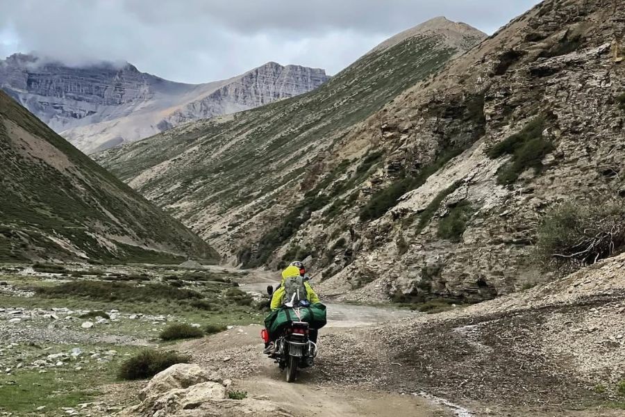
Upper Dolpo is located in Nepal's remote northwestern corner, near the border with Tibet, and is part of the larger Dolpo district of Karnali Province. Although the region comprises over 7,000 square kilometers of high-altitude desert landscape, it is one of the largest, most remote trekking regions in Nepal.
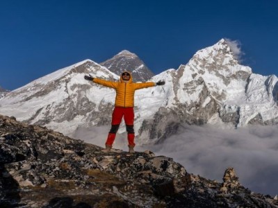
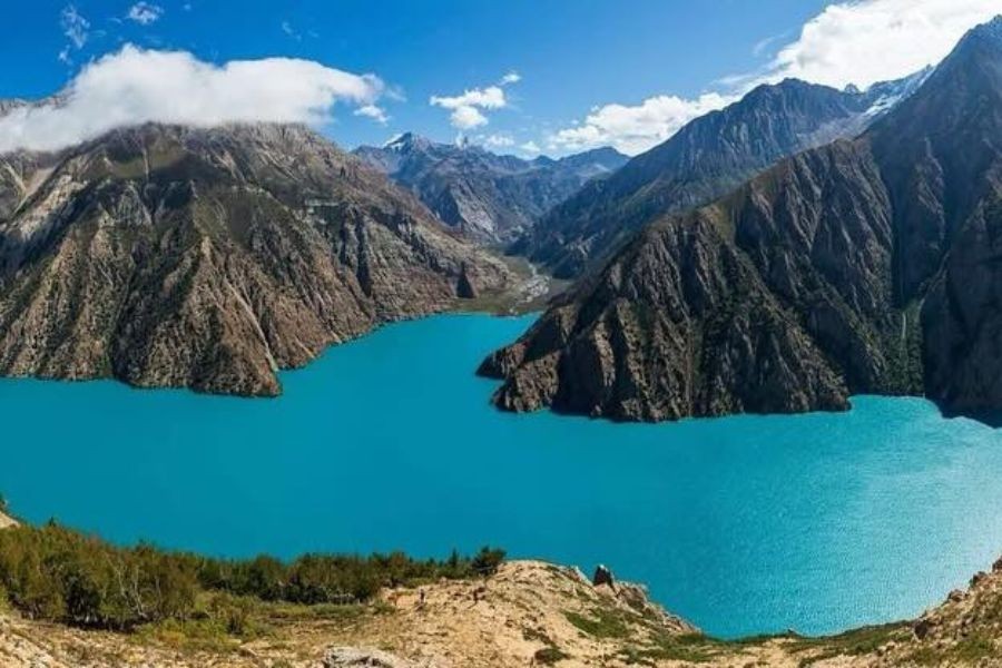
One of the highlights of the Upper Dolpo trekking route map is Shey Phoksundo Lake, Nepal's deepest lake, with stunning turquoise waters reflecting the surrounding snow-capped peaks. The spectacular, ancient Shey Gompa Monastery is also a beautiful spiritual place in this desolate place, with its centuries-old Buddhist tradition and pilgrimage site for worshipers from across the Himalayas.
What is culturally distinctive about Upper Dolpo is its ancient and preserved culture of Tibetan Buddhism. The Dolpo-pa have lived the same way of life for over a thousand years, practicing their ancient customs, using traditional Tibetan dialects to communicate, and following intra-seasonal migration between their summer and winter settlements. Cultural authenticity combined with dramatic landscapes creates an incomparable trekking experience, as if you were living in a different time.
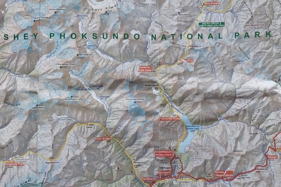
Upper Dolpo Trek Map from Start to End of Your Journey
Your Upper Dolpo trip will commence at Juphal Airport, a small airstrip that acts as the gateway into the Dolpo region. The Juphal to Shey Gompa route is the central route of most Upper Dolpo treks, although to do the full circuit properly usually takes 18 to 21 days.
Key villages and overnight stops include:
- Juphal (2,475m) - Starting with basic lodging facilities.
- Dunai (2,140m) - Administrative center and last major settlement
- Chhepka (2,838m) - First high-altitude acclimatization stop
- Phoksundo Lake Camp (3,611m) - Base camp for lake exploration
- Shey Gompa (4,390m) - Ancient monastery and spiritual center
- Saldang (3,770m) - Largest village in Upper Dolpo
- Dho Tarap (4,040m) - Traditional Bon village with unique culture
On average, the daily trekking hours mark 5-8 hours, while the distance varies from 8-15 kilometers, depending on the terrain difficulty or elevation gain. As the Dolpo Trek map indicates, generally there is a large elevation gain; therefore, it is ideal to start early to keep a good pace for proper acclimatization, as this is also something you will need to manage throughout the days.
Related article: Understanding the Upper Dolpo Trek Difficulty: What Every Trekker Should Know
Altitude Profile and High Passes
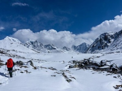
The map showing the passes for Upper Dolpo reveals the three main high-altitude passes that define the challenging nature of this trek. Each pass commands respect, requires the proper preparation, and, if the weather is right and the conditions to cross safely are present.
Kang La Pass (5,115m) is the first major challenge connecting the Phoksundo Lake region to the inner Dolpo valleys. Spectacular views of the peaks surrounding the pass will only be had if you time your crossing correctly; often, the weather starts to change early afternoon.
Jeng La Pass (5,090) is the pass that you cross between Shey Gompa and Saldang village, with prayer flags flying against the bathed mountains in the background. The approach is via high altitude plateaus, so you can hopefully start to confirm your acclimatization status.
Saldang La Pass (5,200m) is the highest of the treks, requiring the best possible hiking conditions and gear. The weather windows can be narrow, hence the importance of flexible itinerary planning.
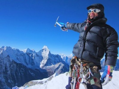
Managing these altitude challenges requires gradual ascent profiles, rest days at elevation, and awareness of altitude sickness symptoms. The greatest level of elevation exposure occurs above 5000 meters, where the oxygen levels drop to about half of sea level concentration.
Distance and Duration Covered in the Map
The total Upper Dolpo trek map features approximately 220-250 kilometers of trail (not including side trips and variations). This is a long trip, done over 18-21 trekking days, making it one of Nepal's longest and most comprehensive high-altitude treks.
On average, you will be trekking 8-15 kilometers per day, but distance can't tell the full story due to the nature of the high-altitude terrain. The altitude-related gains and losses in elevation, combined with high-altitude factors, can make even short trekking days physically taxing.
The ultimate aim of the trekking style we suggest is to provide enough time for acclimatization rather than speed. Good itineraries will have planned rest days. Your trekking pace and ability to gain time an essential parts of allowing the body to acclimatize and having the energy reserves to tackle the toughest days of the trek.
Map Highlights: Key Villages & Landmarks
Shey Phoksundo Lake appears on each Shey Phoksundo trek map, enjoying a length of 5 kilometers and a depth of 145 meters. Its extraordinary wonders provide even the greatest photographer a chance to capture Nepal's beauty at its best because of its brilliant turquoise color, with glacial sediments, minerals, and many other factors.
Shey Gompa Monastery can be described as the spiritual center of Upper Dolpo, with ancient Buddhist artifacts, meditation caves, and a view of the beautiful mountains around it. It's a very special place (it was established in the 11th century) and serves as a welcoming spiritual center for trekkers seeking not only culture but spiritual reflection in a religious location that is considered one of the most remote in the world.
Saldang Village introduces trekkers to the typical architecture and way of life of the local Dolpo people, with their flat-roofed stone homes, barley fields, and yaks, embracing a lifestyle based on agriculture, which many have experienced first-hand. Typically, local families invite trekkers into their homes for a traditional meal (when you are lucky) and cultural exchanges.
Dho Tarap Valley is home to the unique Bon religion alongside Buddhist traditions. It is not very common to be pictured in this remote high valley, which promotes ancient rituals from pre-Buddhism spiritual practices. The valley is characterized by wide-open spaces with sheer mountain peaks creating more striking landscape pictures.
There are unspoiled distant valleys between the major settlements that provide hidden treasures such as ancient caves, wildlife viewing opportunities, and beautiful nature, which few travel through during their journeys to this remote area.
Related article: Upper Dolpo Trek Packing List: Essential Trekking Gear Guide
Permits & Restricted Area Details on the Map
Knowing the permit requirements is crucial when studying your Upper Dolpo trek map, as this area operates under strict governmental regulations that preserve its unique culture as well as its remarkable, untouched environment. The complex permit system means that planning and paperwork must be meticulously agreed upon long before your arrival.
Restricted Area Permits
Upper Dolpo is classified as a restricted area in Nepal; therefore, special permits/spending beyond the average trekking documentation are required. The Restricted Area Permit (RAP) costs $500 per person for the first ten days, plus $50 for each additional day. Such a high fee reflects the government's commitment to limiting visitor capacity while maintaining authenticity.
Your trekking route map for Upper Dolpo must match your permit. If your route goes off the permitted path, you will incur penalties serious enough to terminate your trip. The permit information identifies the exact entry and exit points of the trek, points where you can camp, as well as restricted areas for camping and photography.
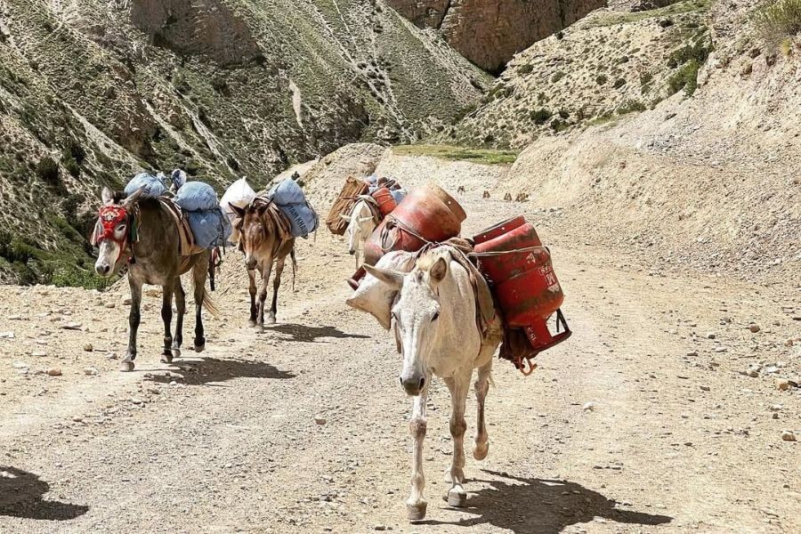
A trekking group of which you are a member must be arranged through a trekking agency; independent trekking is not permitted in Upper Dolpo. Your group must be at least two trekkers, plus the government-assigned liaison officer who will ensure you comply with the local regulations and cultural norms.
Shey Phoksundo National Park Entry
The Shey Phoksundo trek map overlaps significantly with Nepal's largest national park, for which you will need to get separate entry permits and permits to access. Entry into the Shey Phoksundo National Park costs NPR 3,000 for foreign nationals. You will also incur a payment to gain entry for porters and another for camping permissions.
Camping, collection of waste, and interaction with wildlife are strictly controlled by the park; you should expect the trek map to specify the areas where you can camp for the night. Camping unsanctioned will attract heavy fines and legal issues.
As one would expect with protected conservation land, there are a number of rules as well for using the land, including protected and non-protected plants, disturbing wildlife, and removing cultural sites. As noted on the Upper Dolpo passes map, there are protected areas of land that might have specific permits for photography at high altitude, as well as for conducting research on them.
Related article: Best Time to Trek Upper Dolpo, Nepal - Spring & Fall Guide
Mapping Checkpoints and Local Administration
Strategic checkpoints exist throughout the Dolpo region map of Nepal, which are mandatory registration areas at which permits are checked while also logging trekker information. Some of the more pivotal checkpoints are the Juphal airport, Dunai police post, Chhepka immigration office, and the Shey Gompa monastery administration.
They keep records of trekker movement, permit metamorphic log in, group specifics, and so on. Make sure your Upper Dolpo trail map denotes these administrative stops to ensure proper documentation and to limit the opportunity for delays or complications later down the trail.
Local village committees, run by the respective communities, maintain a registration system in places such as Saldang and Dho Tarap, where village leaders visually verify the permits and usually collect a local development fee. These local fees support village infrastructure and cultural accounting programmes for the benefit of the Dolpo communities as a whole.
Within the Dolpo region, knowing where checkpoints are located also assists with your itinerary planning, and process times can vary depending on the size of the group and what you are doing (permitting processes). We recommend that people arrive at relevant, larger checkpoints as early as possible to limit processing time and mitigate possible late afternoon delays that may cause undue hindrance the following day.
FAQs on Upper Dolpo Trek Map
Is an Upper Dolpo trek map available online?
Yes, you can find an Upper Dolpo map to download online from many trekking sites and mapping applications. However, using paper maps is a good practice as a backup, as these are likely to serve you better than your electronic device in remote settings. Use downloaded GPS tracks as well as maps for added peace of mind during navigation.
Do I need a guide if I have a map?
While detailed maps can provide some valuable navigation information, hiring an experienced local guide is a good practice for the Upper Dolpo. Hiring guides will be able to provide valuable cultural perspective, assess weather, and help with the best routes, and basic emergency help- things you just can't do with a map. Typically, trekking maps of the Dolpo region, like the map of the Nepal Dolpo district, show complex trail networks with local knowledge being invaluable.
Can I download the Upper Dolpo map before departure?
For sure! Download comprehensive maps of the Trekking route of Upper Dolpo before departure to access offline maps for the journey's duration. Your GPS devices or map-enabled smartphone tracking apps will work well, but keeping track of your battery remains essential, especially in places without recharging support.
Conclusion
The Upper Dolpo Trek map is not just an aid to getting you around; it is your passport to the experience of one of Nepal's most amazing wilderness journeys. This map is a complete mapping experience to assist you in understanding the scale, challenges, and immense opportunities waiting for you in the trans-Himalayan environment of Upper Dolpo. From the aquarium blue of Phoksundo Lake to the ancient knowledge of Shey Gompa, from high & challenging passes to friendly village communities, you will use your Upper Dolpo map to traverse landscapes that have hardly changed in centuries. Good preparation of your map, together with expert advice and a good understanding of the local culture and history, will ensure your Upper Dolpo journey transforms you into an adventure in one of Asia's last undiscovered Kingdoms.
Plan accordingly, prepare appropriately, and let your in-depth Dolpo trek route map take you on the adventure of a lifetime in Nepal's most pristine and rewarding trekking destination.
With concise planning, thorough preparation, and the help of your detailed Dolpo trek route map, you are off on an adventure of a lifetime in Nepal's most remote yet rewarding trekking destination. Are you ready to begin your Upper Dolpo adventure with a proper guide and a commitment to sustainable trekking practices? Connect with Himalayan Ecological Trekking today to start planning your journey into this unbelievable wilderness.
Inquire Now: [email protected]
Expert Consultation: WhatsApp: +977 9851006023 (Bikesh)